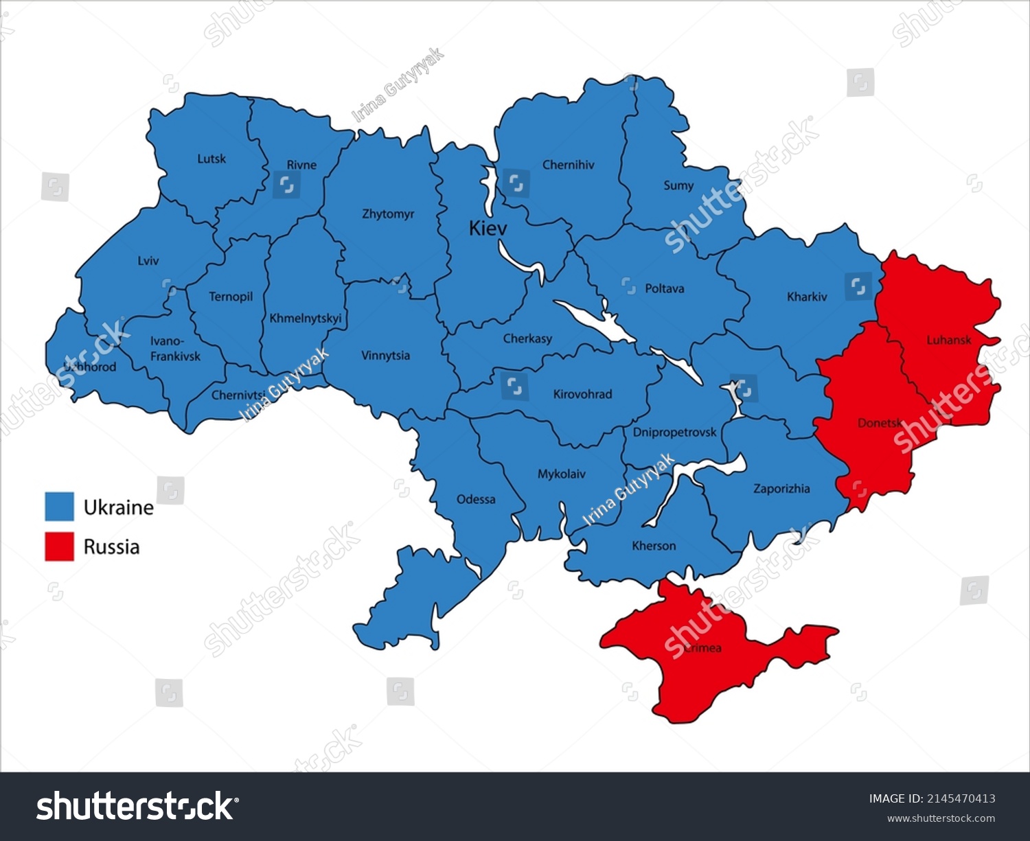
Map of Ukraine and separated regions of Donetsk, Luhansk and Crimea • Royalty Free Stock Photo

Royalty Free Stock Image from Shutterstock 2145470413 by Irina Gutyryak

Download this image

Buy this photo Buy this photo

Use coupon AVOPIX10 and get 10% discount

Shutterstock ID 2145470413
Added April 13, 2022 (2 years ago)
Ratio 1.3332
Adult NO
Vector size (EPS) Scalable vector
Huge size (JPG) 4001 x 3001 px, 1.2 Mb, 300 DPI

Categories: Signs/Symbols

Boundary Country Politics 2022 russian invasion of ukraine Regions City Curve Republic Unite Flat design Crimea White background Computer graphic Division Red Cut out Outline Separatism Military invasion Russia Vector Annexed Donetsk Map Geographic area Lugansk Armed forces War Cartography Physical geography Blue District Ukraine Illustration Contour line Conflict


Download Free Images

More than 400 000 free photos available for download

Boundary Country Politics 2022 russian invasion of ukraine Regions City Curve Republic Unite Flat design Crimea White background Computer graphic Division Red Cut out Outline Separatism Military invasion Russia Vector Annexed Donetsk Map Geographic area Lugansk Armed forces War Cartography Physical geography Blue District Ukraine Illustration Contour line Conflict


Map of Ukraine and separated regions of Donetsk, Luhansk and Crimea is royalty free stock photo by Irina Gutyryak.
You can buy this royalty free stock image on Avopix.com and Shutterstock website.
With our discount coupon „AVOPIX10“ you will save 10 %.